|
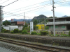
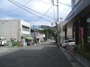
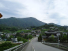
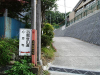
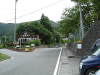
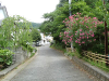
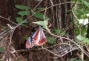
起点のJR中央本線「猿橋駅」
(37 KB)
|
|
|
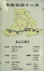
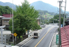
大月市の「秀麗富嶽十二景」の案内板
(37 KB)
|
|
|
猿橋駅前
(31 KB)
|
|
|
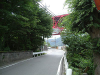
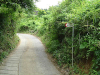
歩道橋を渡って右へ、セブンイレブンを左へ
(40 KB)
|
|
|
高速が見えてくる
(34 KB)
|
|
|
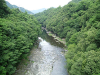
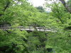
途中の橋から千曲川をのぞく
(54 KB)
|
|
|
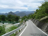
正面には扇山も見えてくる
(28 KB)
|
|
|
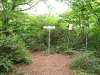
本来の登山口はここを左折だが、猿橋を見に行く
(43 KB)
|
|
|
しばらくゆくと、猿橋が見えてくる
(65 KB)
|
|
|
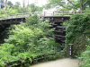
猿橋は「日本三大奇橋」のうちの一つ
(54 KB)
|
|
|
他の二つは錦帯橋と祖谷のかずら橋ですね
(64 KB)
|
|
|
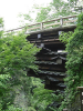
橋桁がなく、屋根のようなものが積み重なっている
(57 KB)
|
|
|
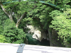
猿橋から下をのぞく
(61 KB)
|
|
|
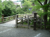
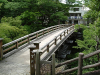
土産物屋や遊歩道がある
(53 KB)
|
|
|
猿橋近くの登山口
(47 KB)
|
|
|
神社に出る
(51 KB)
|
|
|
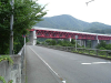
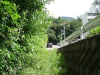
高速道路をくぐる
(40 KB)
|
|
|
高速の測道から登山道が延びている
(36 KB)
|
|
|
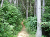
やっと登山らしい道になる
(67 KB)
|
|
|
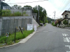
マンションの横に出てしまうので、まっすぐ進む
(59 KB)
|
|
|
テニスコートを左に見ながら進む
(37 KB)
|
|
|
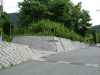
小学校の案内板があるところを右折する
(44 KB)
|
|
|
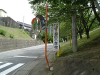
登山口への案内もある三叉路を左に取る
(37 KB)
|
|
|
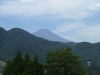
富士山が見え始める
(19 KB)
|
|
|
直線で急傾斜の坂道をゆく
(34 KB)
|
|
|
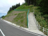
左右どちらからも登ることができるが、左がお進め
(41 KB)
|
|
|
左の道を取ればコンクリート舗装の道を行く
(49 KB)
|
|
|
ずっときつい登りが続く
(57 KB)
|
|
|
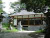
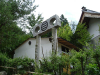
非公開の和田美術館の裏を通る
(47 KB)
|
|
|
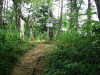
やっと登山道らしくなる
(72 KB)
|
|
|
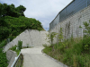
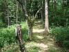
右は大回りになるので、左の道を取る方がよい
(69 KB)
|
|
|
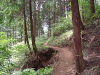
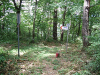
大きく掘れているところもある
(64 KB)
|
|
|
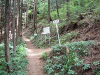
所々に案内板がある
(57 KB)
|
|
|
大月市街が見え始める
(36 KB)
|
|
|
尾根に出ると右が頂上
(66 KB)
|
|
|
尾根を左(西)に行くと、すぐに大同山山頂(907m)がある
(73 KB)
|
|
|
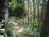
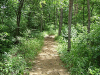
尾根道は明るくて歩きやすい
(71 KB)
|
|
|
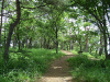
木立の中をゆく
(72 KB)
|
|
|
剣山でも見られる渡り蝶の「アサギマダラ」を発見
(47 KB)
|
|
|
山頂手前は広くて明るい道になっている
(76 KB)
|
|
|
百蔵山(1003m)山頂
(70 KB)
|
|
|
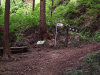
三角点と説明板
(53 KB)
|
|
|
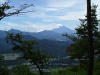
木々の間から見える富士山
(33 KB)
|
|
|
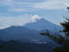
大きく写すこともできる
(20 KB)
|
|
|
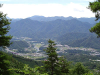
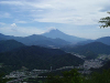
写す方向を変えると、大月市街を入れた写真も撮影できる
(21 KB)
|
|
|
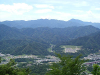
正面には道志山塊の幽玄な眺め
(32 KB)
|
|
|
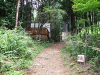
山頂から東へ進むと扇山縦走路への分岐がある
(66 KB)
|
|
|
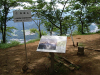
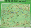
駅にある登山ルートも入った「猿橋駅周辺案内図」
(57 KB)
|
|
|
|